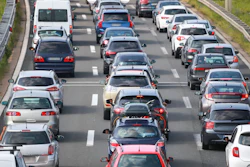
WAZE is a handy app that relies on folks like you — those often on the road all over the U.S. — to help other travelers stay alert to any number of issues: traffic congestion, road hazards, accidents, highway shutdowns, even roadkill and potholes.
Its primary purpose is to provide information in real time to help folks, including professional drivers, be aware of and avoid potential tie-wasting or hazardous events. It can also help you map a trip and see what’s happening up ahead.However, a guy in Google’s News Lab compiled a bunch of data from WAZE and came up with some interesting maps. He shows which states’ WAZE users use the app the most to report various highway perils.
Road conditions/events and the top WAZE reporting locations include:
- Accidents: Idaho
- Hazards in the road: Wyoming
- Construction: Vermont
- Potholes: Washington, D.C.
- Roadkill: South Dakota
- Animals alongside the road: Montana
- Traffic jams: California
- Missing road signs: Idaho
- Icing conditions: Idaho
- Flooding: Idaho
- Fog: Washington state
[gtbutton link=”http://googletrends.github.io/iframe-scaffolder/#/view?urls=Accident%7Chttps:%2F%2Fgoogledataorg.cartodb.com%2Fu%2Fgoogledata%2Fviz%2Fc03375e0-3436-11e5-b785-42010a14cb63%2Fembed_map%3Fzoom%3D3%26center_lat%3D38.0380134%26center_lon%3D-99.6760914,Traffic%20jams%7Chttps:%2F%2Fgoogledataorg.cartodb.com%2Fu%2Fgoogledata%2Fviz%2F254cace8-3438-11e5-9764-42010a14cb63%2Fembed_map%3Fzoom%3D3%26center_lat%3D38.0380134%26center_lon%3D-99.6760914,Hazard%20on%20road%7Chttps:%2F%2Fgoogledataorg.cartodb.com%2Fu%2Fgoogledata%2Fviz%2F75ad1b50-3438-11e5-b228-42010a149c0c%2Fembed_map%3Fzoom%3D3%26center_lat%3D38.0380134%26center_lon%3D-99.6760914,Hazard:%20Construction%7Chttps:%2F%2Fgoogledataorg.cartodb.com%2Fu%2Fgoogledata%2Fviz%2F67bcf5f6-33de-11e5-b4fd-42010a14cb63%2Fembed_map%3Fzoom%3D3%26center_lat%3D38.0380134%26center_lon%3D-99.6760914,Hazard:%20Pot%20Holes%7Chttps:%2F%2Fgoogledataorg.cartodb.com%2Fu%2Fgoogledata%2Fviz%2Fab65470e-33de-11e5-9764-42010a14cb63%2Fembed_map%3Fzoom%3D3%26center_lat%3D38.0380134%26center_lon%3D-99.6760914,Hazard:%20Missing%20road%20signs%7Chttps:%2F%2Fgoogledataorg.cartodb.com%2Fu%2Fgoogledata%2Fviz%2F0f4569ac-33df-11e5-928a-42010a149c0c%2Fembed_map%3Fzoom%3D3%26center_lat%3D38.0380134%26center_lon%3D-99.6760914,Hazard:%20Roadkill%7Chttps:%2F%2Fgoogledataorg.cartodb.com%2Fu%2Fgoogledata%2Fviz%2F7e0c196c-33da-11e5-a2d7-42010a149c0c%2Fembed_map%3Fzoom%3D3%26center_lat%3D38.0380134%26center_lon%3D-99.6760914,Hazard:%20Animal%7Chttps:%2F%2Fgoogledataorg.cartodb.com%2Fu%2Fgoogledata%2Fviz%2F636ad7c8-33e0-11e5-a8e2-42010a14cb63%2Fembed_map%3Fzoom%3D3%26center_lat%3D38.0380134%26center_lon%3D-99.6760914,Hazard:%20Ice%7Chttps:%2F%2Fgoogledataorg.cartodb.com%2Fu%2Fgoogledata%2Fviz%2F27cc04ee-33e0-11e5-b2cb-42010a149c0c%2Fembed_map%3Fzoom%3D3%26center_lat%3D38.0380134%26center_lon%3D-99.6760914,Hazard:%20Flood%7Chttps:%2F%2Fgoogledataorg.cartodb.com%2Fu%2Fgoogledata%2Fviz%2F96c38826-33e1-11e5-970c-42010a149c0c%2Fembed_map%3Fzoom%3D3%26center_lat%3D38.0380134%26center_lon%3D-99.6760914,Hazard:%20Fog%7Chttps:%2F%2Fgoogledataorg.cartodb.com%2Fu%2Fgoogledata%2Fviz%2F6307677c-33e2-11e5-b2cb-42010a149c0c%2Fembed_map%3Fzoom%3D3%26center_lat%3D38.0380134%26center_lon%3D-99.6760914&layout=narrative&theme=blue-grey&title=The%20Waze%20alert%20map%20of%20America&description=US%20states%20ranked%20by%20%25%20of%20alerts%20reported%20by%20users%20for%20each%20issue.%20Press%20the%20buttons%20below%20to%20see%20different%20alerts.%20’Accident’,%20’Traffic%20Jams’%20and%20’Hazard%20on%20road’%20are%20ranked%20as%20%25%20of%20total%20user%20alerts,%20all%20others%20within%20the%20’Hazard’%20category”]See how states stack up for various driving issues[/gtbutton]